Carbon stock estimation
Combine tree count and height with species-aware allometric methods to estimate above-ground biomass and carbon stock.
Forest Agent
FOREST & LAND
Cropin combines high-resolution imagery, Earth observation and domain models to measure plantations, estimate carbon stock and turn forest loss into verifiable evidence.
01 / MODELS AVAILABLE
Five connected capabilities turn imagery into measurements and operational evidence.
Combine tree count and height with species-aware allometric methods to estimate above-ground biomass and carbon stock.
Detect individual crowns from high-resolution satellite, aerial or drone imagery.
Estimate height using stereo image pairs and connect it to inventory and biomass assessment.
Classify plantation blocks by age to support replacement planning and productivity assessment.
Monitor change through time, rank risk and preserve the evidence used for human review.
02 / CARBON INTELLIGENCE
The method begins with what can be measured: individual trees, crown structure and height. Those measurements feed the selected allometric model and produce plot-level biomass and carbon estimates.
03 / IN PRACTICE
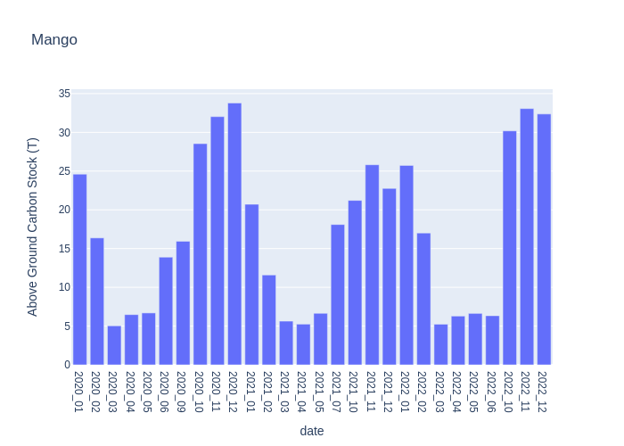
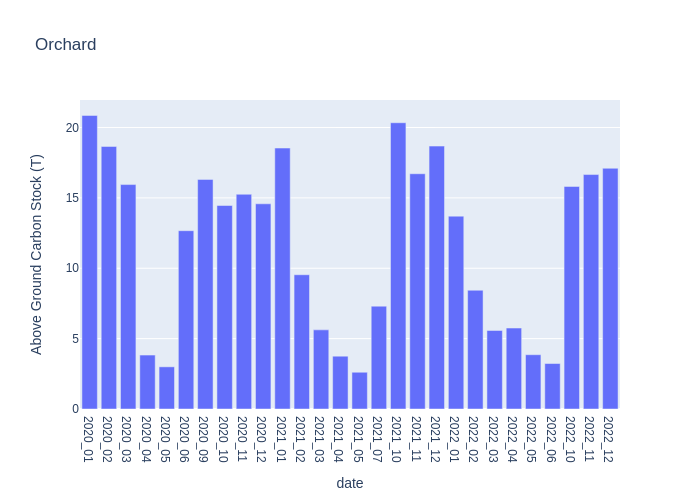
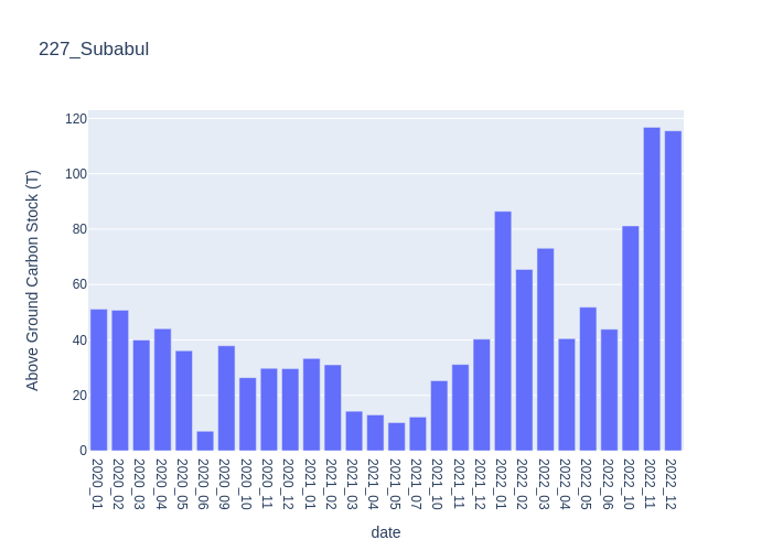
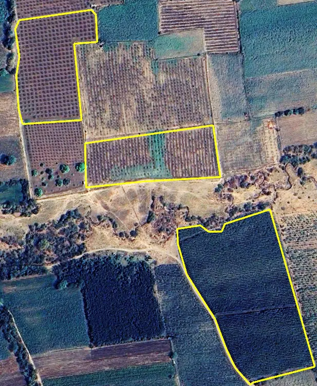
High-resolution imagery connects named plantation boundaries with monthly above-ground biomass estimates for Mango, Orchard and Subabul.
04 / TREE INTELLIGENCE
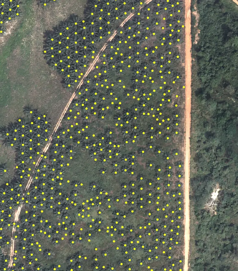
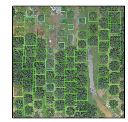
Crown detection converts high-resolution imagery into a countable asset layer. Operators can use the output for inventory, plantation monitoring and field verification.
Satellite, aerial or drone imagery selected for the asset and decision.
Crown locations, counts and spatial exceptions linked to the plantation boundary.
Prioritize field checks and connect measurements to biomass or carbon workflows.
05 / PLANTATION AGE
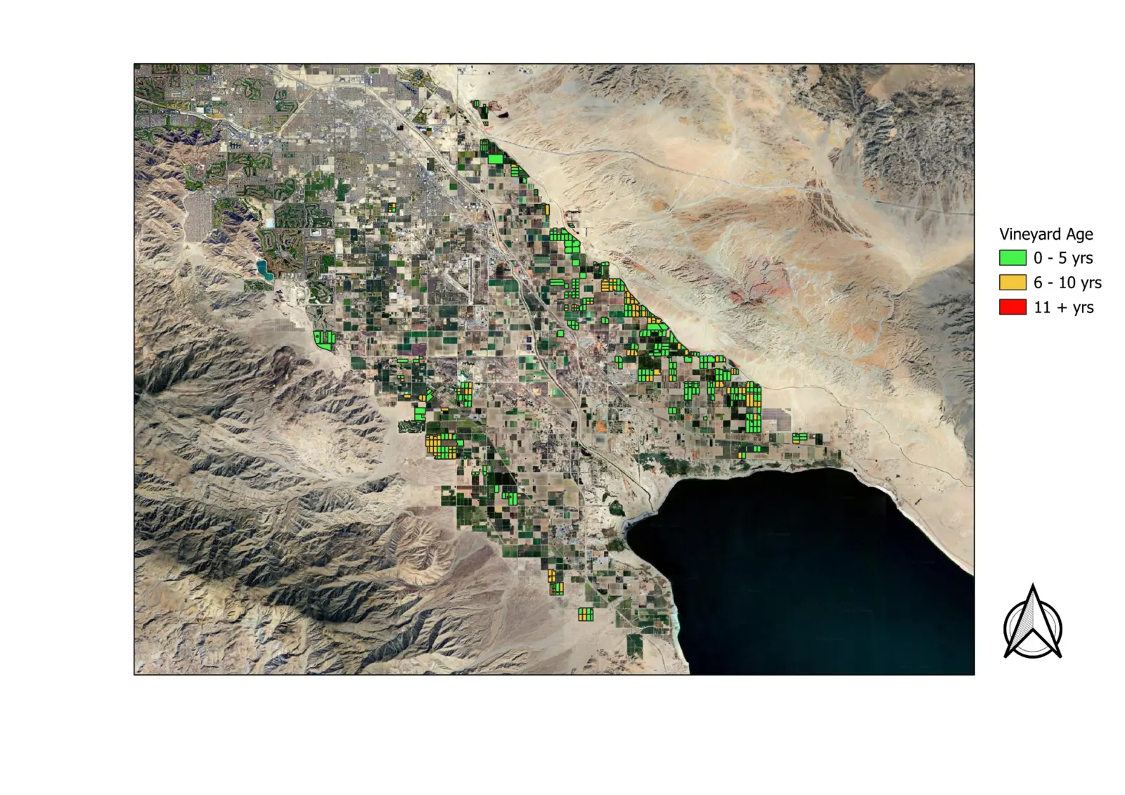
A Riverside County study classified vineyard blocks into age groups and summarized the planted area represented by each group.
No plots aged 11 years or more appeared in the supplied study result.
06 / DEFORESTATION EVIDENCE
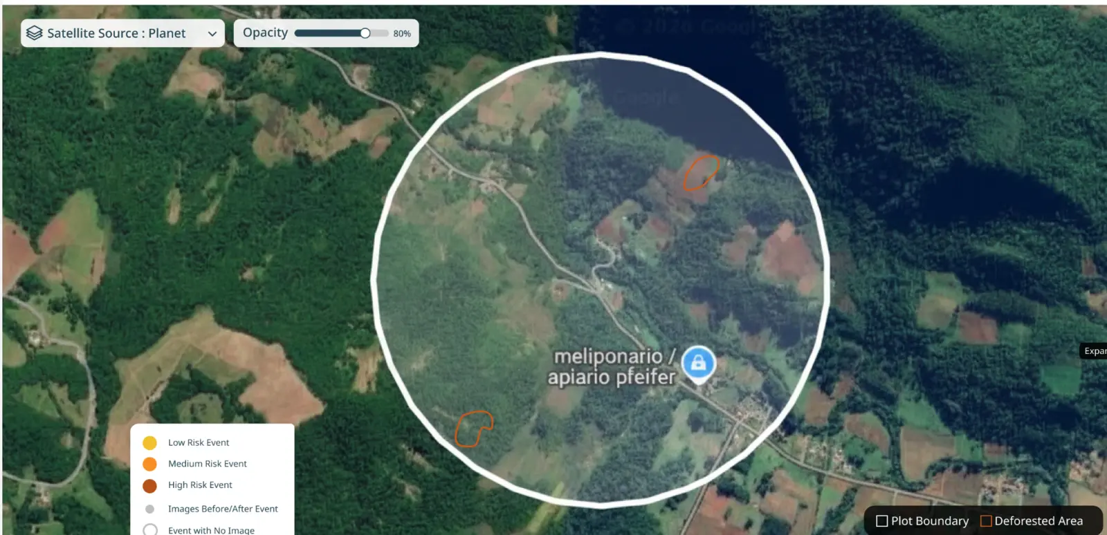
The same experience connects portfolio screening, plot history, satellite evidence and human confirmation. Every reviewed event keeps its location, observation window and evidence record.
Review model confidence and satellite evidence before changing status or creating a case.
07 / DECISIONS ENABLED
Cropin provides observation, measurement and review workflows. Certification and final program assurance remain with the responsible organization and its appointed auditors.
Connect tree inventory, height and biomass estimates to spatial evidence.
Use crown counts and age classification to target field verification and planning.
Preserve the location, time window, source imagery and human decision behind each event.
Forest & Land models already produce measurable outputs. Cropin is extending OrbitAI from Food-Ag into guided forest investigation and governed action workflows.
Start with the asset and decision