01 / PLOT OPERATING VIEW
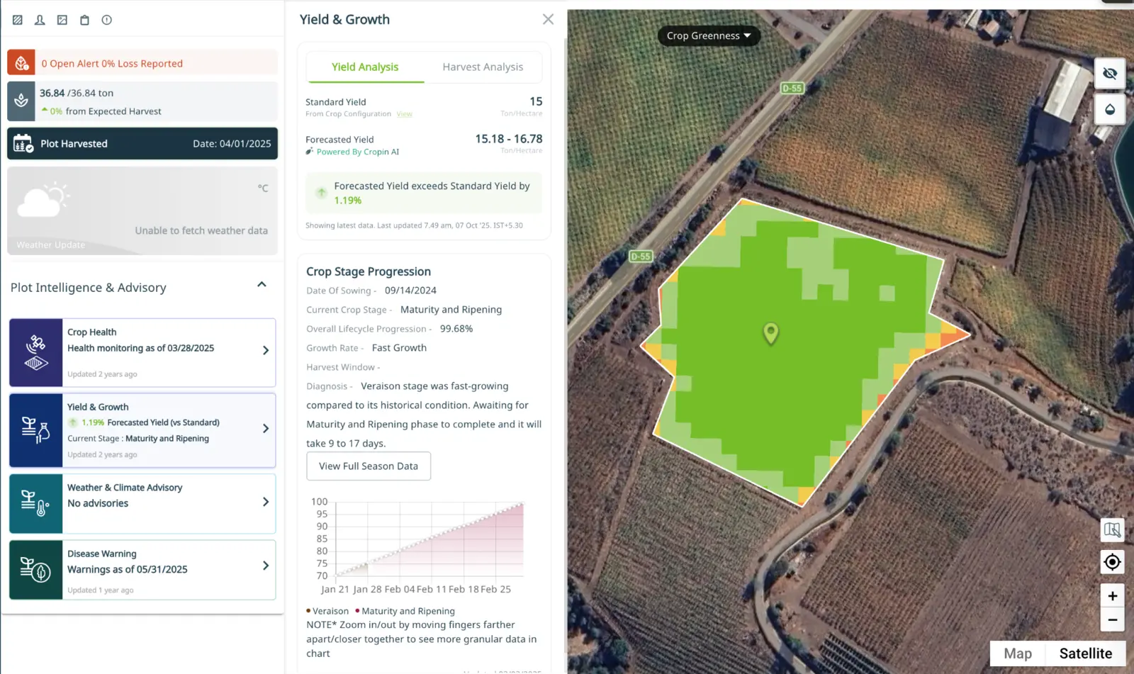
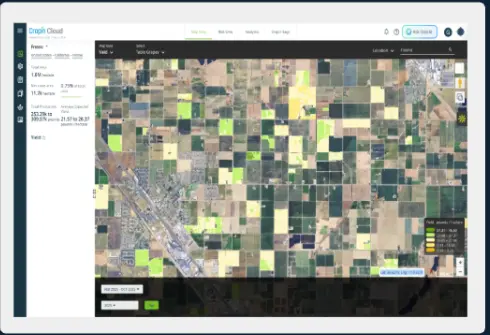
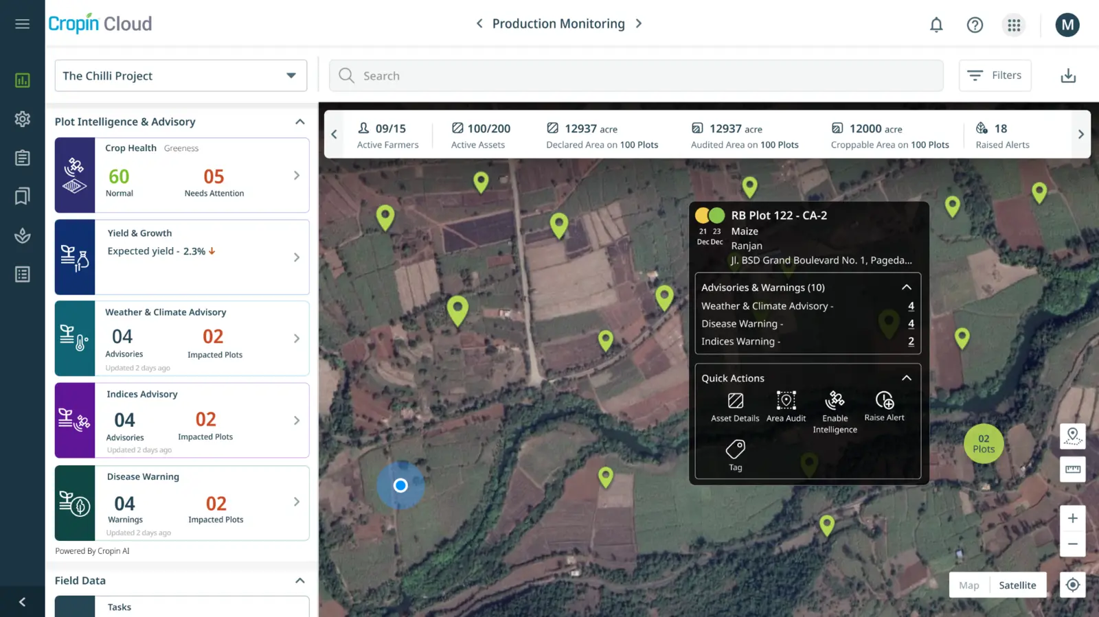
Begin with a verifiable view of every plot.
Bring crop, season, area, field observations, weather and current risk into one operating surface for field and enterprise teams.
IDENTITY · CONTEXT · STATUSDomain Intelligence
Cropin Intelligence turns field, Earth, weather and operational signals into verified intelligence for Food-Ag, and a reusable model layer for Forest, Water, Energy and Infrastructure workflows.
Intelligence architecture
Food-Ag is the proven core. Cropin combines verified ground truth, geospatial and weather data, a deep crop knowledge graph and 22+ proprietary models to make physical change operationally useful.
01 / IN PRACTICE · FOOD-AG
Start with the plot. Observe crop development, detect material risk and forecast the production outcome early enough to change it.
Bring crop, season, area, field observations, weather and current risk into one operating surface for field and enterprise teams.
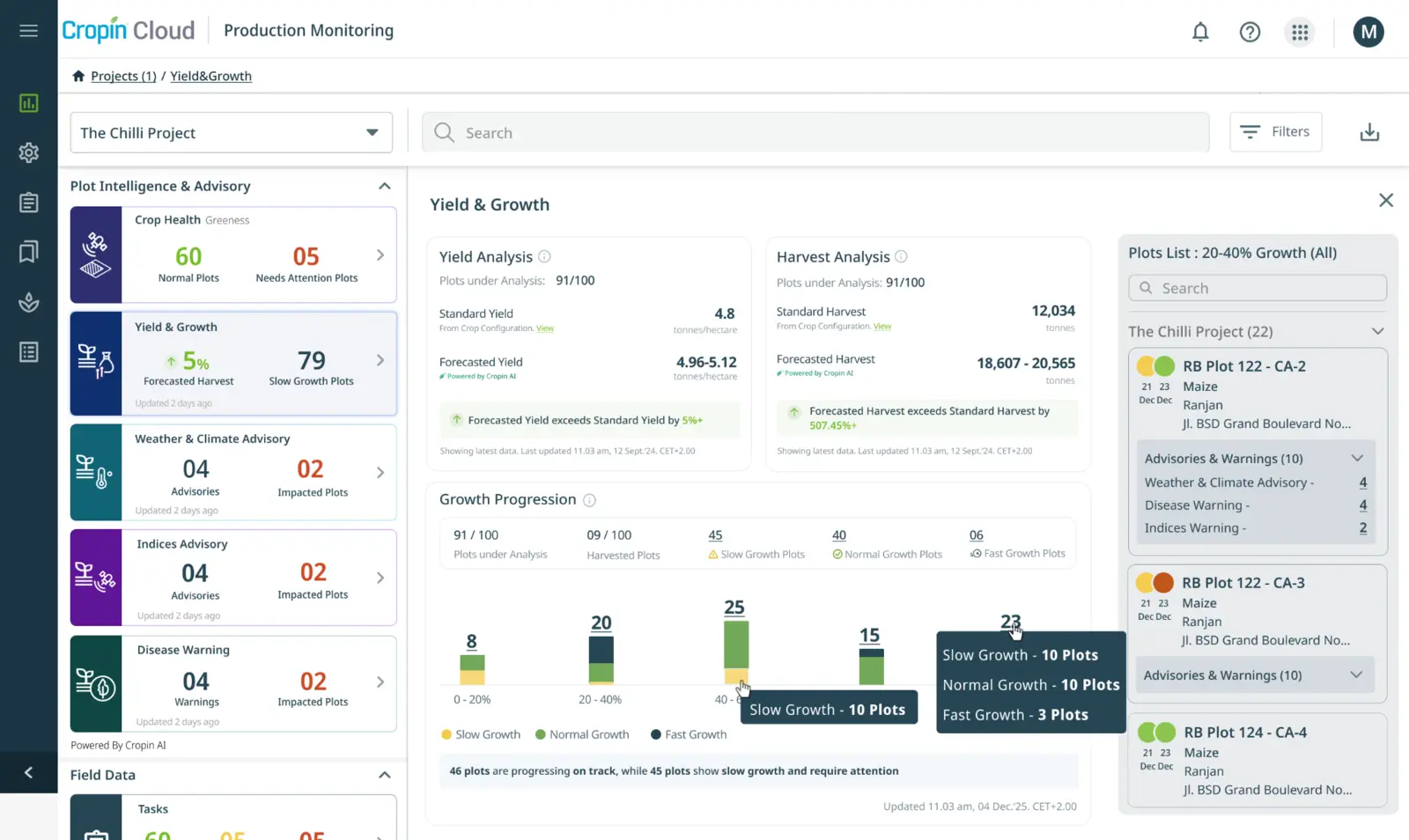
IDENTITY · CONTEXT · STATUSInterpret crop stage and relative growth so agronomy, sourcing and production teams can see whether the season is progressing as expected.
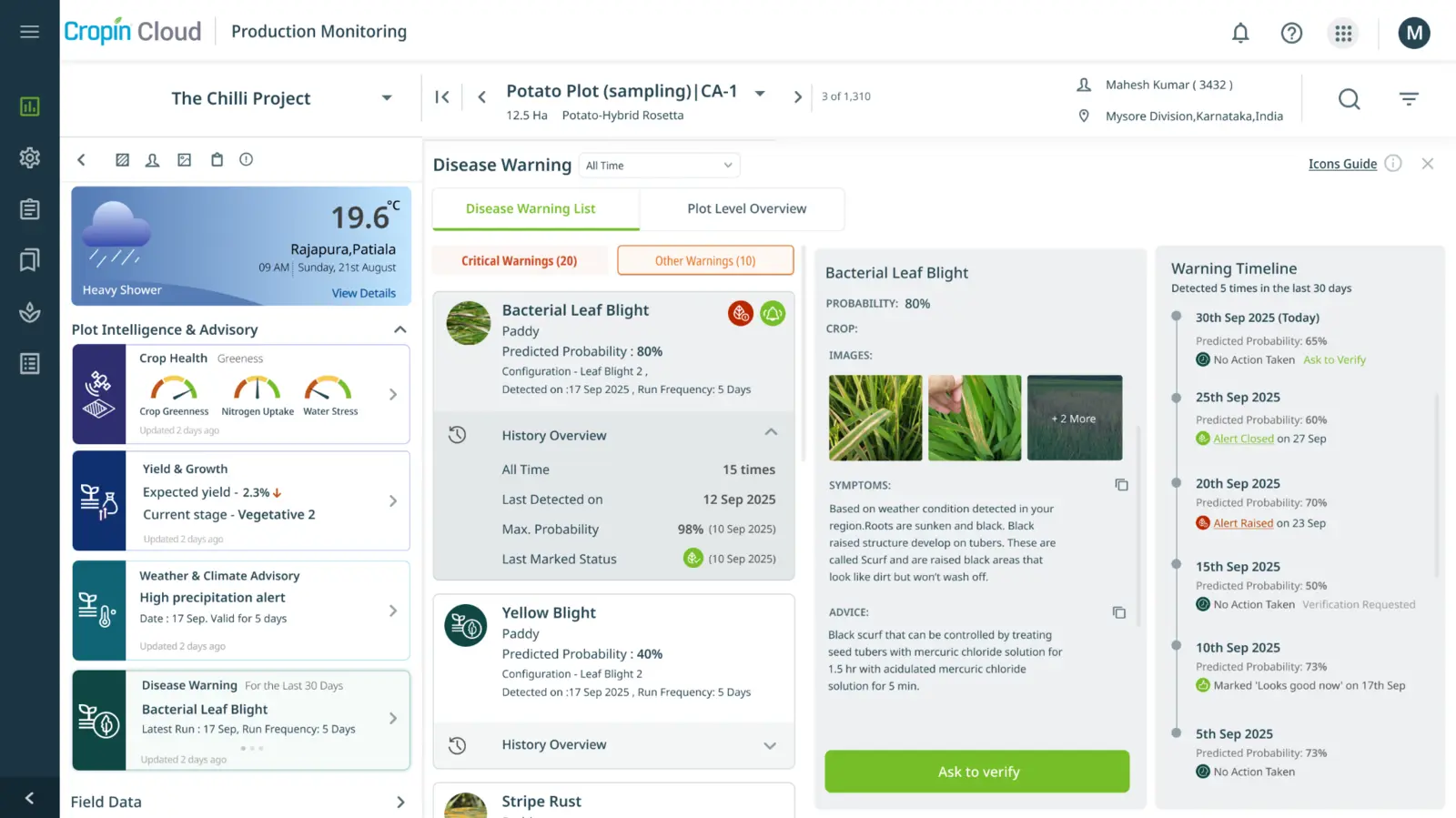
STAGE · VIGOR · EXCEPTIONSCombine crop stage, weather, humidity and disease models to prioritize inspection and intervention where it matters first.
RISK · TIMING · RESPONSEForecast yield and harvest timing early enough to influence procurement, processing, logistics and working-capital decisions.
YIELD · HARVEST · SUPPLY02 / INTELLIGENCE FOUNDATION
Each model answers a focused physical-world question. Together they explain how conditions are changing, what outcome is likely and where attention is required.
Crop detection, acreage estimation and crop classification across plots and regions.
Stage classification, relative growth and harvest-readiness intelligence.
Plot and regional yield forecasting with transparent time windows and uncertainty.
Disease-conducive condition warnings, crop-health signals and inspection priority.
Water stress, irrigation context and nitrogen-uptake intelligence.
Hyperlocal weather, historical patterns, extremes and climate-risk scenarios.
Land-use change, deforestation, canopy, tree and carbon intelligence.
Plot scores, regional benchmarks and explainable risk indicators.
03 / IN PRACTICE · REGIONAL
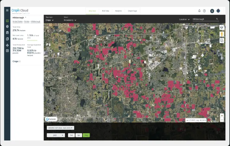
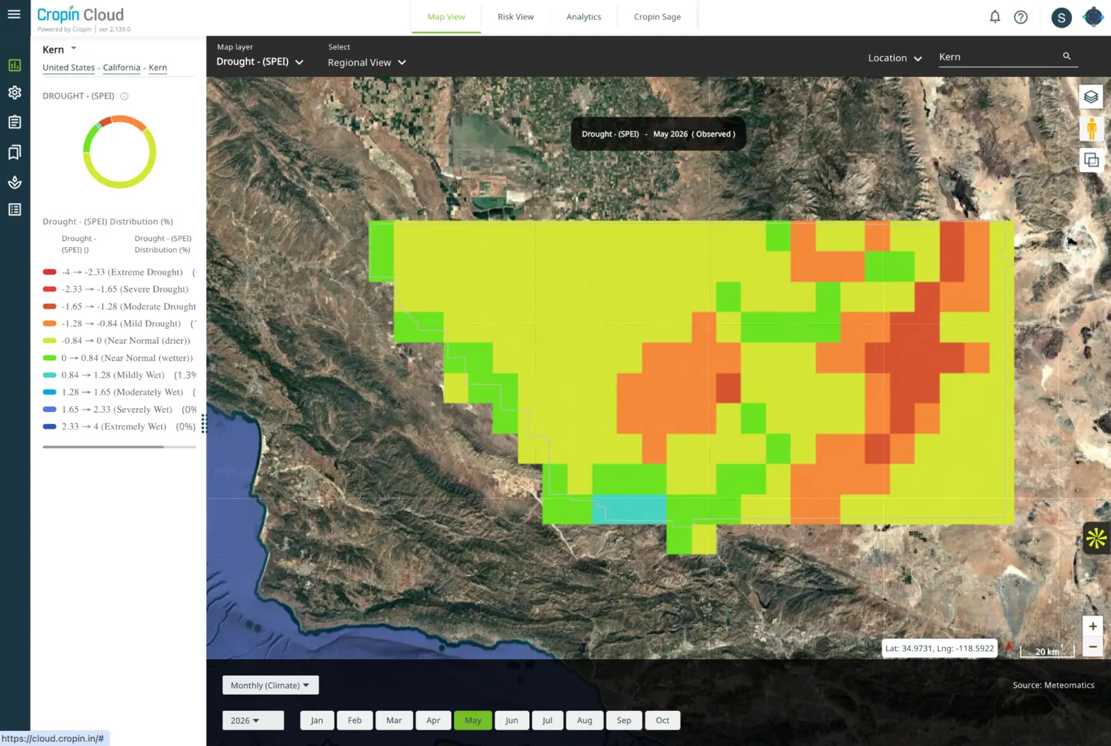
Regional Intelligence connects crop distribution, production, weather, water and climate so sourcing, risk and public-sector teams can act across large geographies.
Aggregate acreage, crop stage, health and yield signals across sourcing regions without losing the local context behind each forecast.
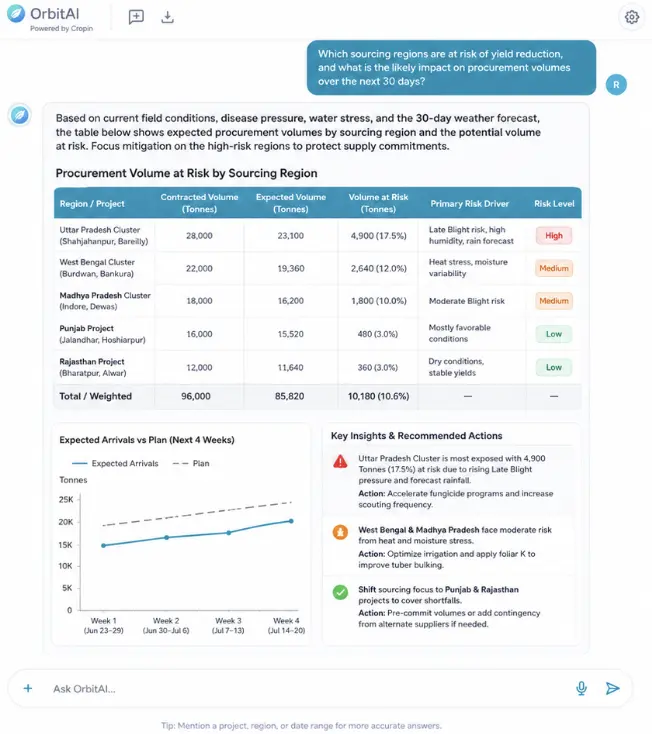
ACREAGE · YIELD · ORIGINCompare expected production with weather, water and crop-condition risk to guide sourcing diversification and commercial planning.
VOLUME · TIMING · EXPOSUREConnect regional drought indicators with crop distribution and production context so teams can distinguish broad climate headlines from material business risk.
DROUGHT · WATER · SCENARIOS04 / DECISION LAYER · ORBITAI
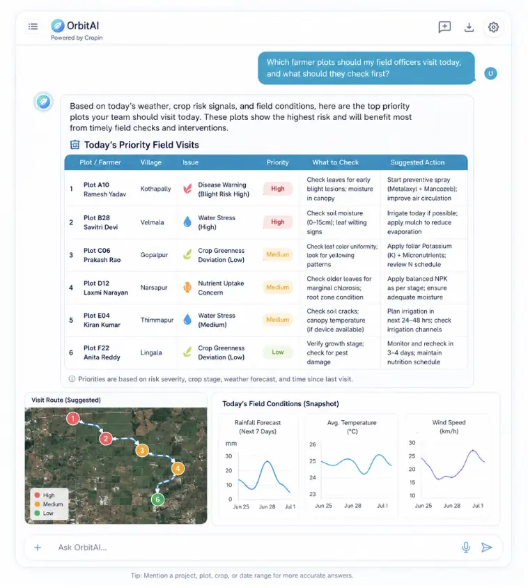
OrbitAI reasons across Cropin Intelligence and enterprise context, explains the evidence and advances the next governed workflow through chat or voice.
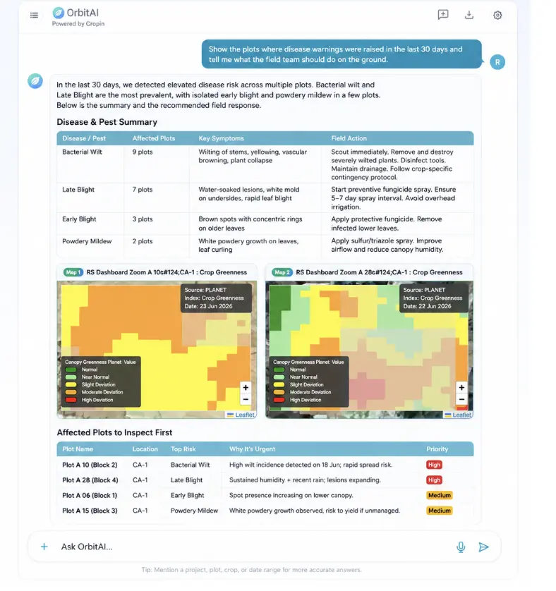
OrbitAI combines disease warnings, crop stage, weather and field context to explain urgency and prepare a reviewable response.
EXPLAIN · PRIORITIZE · RESPONDAsk which origins, suppliers or collection centers are at risk, then connect the answer to volume, timing and intervention options.
SUPPLY · RISK · REALLOCATIONPrioritize field visits and recommended checks using plot evidence, model confidence and enterprise operating rules.
EXCEPTIONS · TASKS · VERIFICATION05 / PHYSICAL-WORLD EXTENSIONS
The architecture can be configured around other physical systems without overstating maturity. Forest & Land and Water models are available; Energy and Infrastructure are upcoming.
 MODELS AVAILABLE
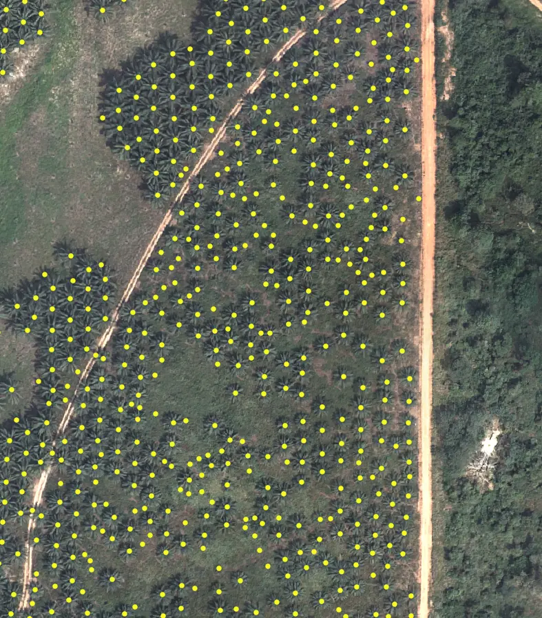
Tree inventory, plantation age, deforestation, biomass and carbon evidence.
Explore Forest intelligence ↗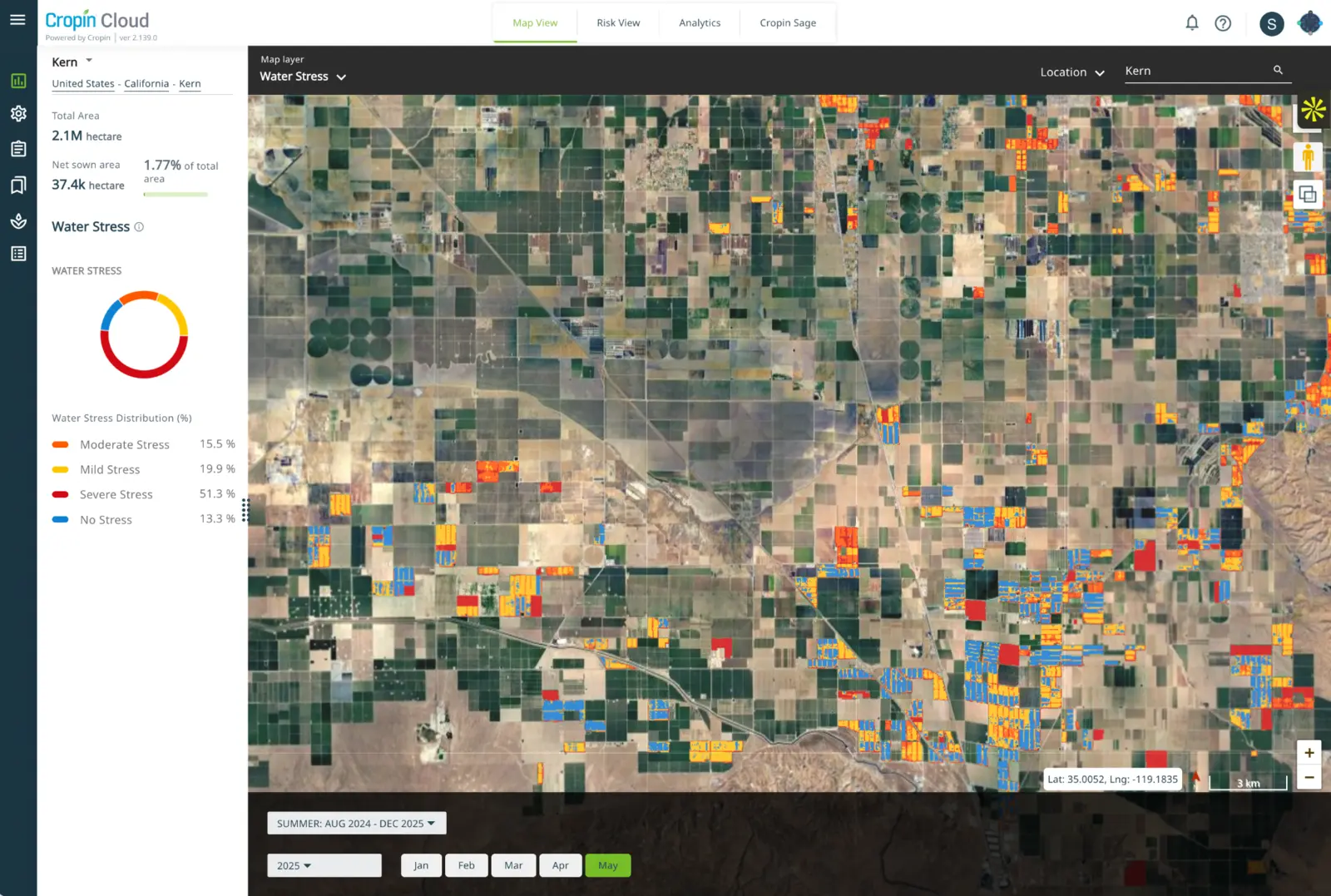 MODELS AVAILABLE
Water stress, drought, basin conditions and crop-production exposure.
Explore Water intelligence ↗UPCOMINGVegetation, fire, weather and climate exposure around distributed assets.
Explore the domain ↗UPCOMINGFlood, erosion, subsidence and vegetation exposure across corridors and assets.
Explore the domain ↗06 / ENTERPRISE PROOF
Cropin Intelligence is grounded in years of deployment across seasons, crops, operating models and geographies, not assembled as a generic AI layer.
07 / FREQUENTLY ASKED QUESTIONS
Explore how Food-Ag, banking, insurance, utilities, Forest & Water and infrastructure teams can apply the intelligence architecture to their own physical-world decisions.
Cropin Intelligence is the domain-model layer of Cropin Cloud. It converts field, Earth, weather, climate and operational data into predictive and prescriptive intelligence for physical-world decisions.
Food-Ag teams use it to monitor crop progression, forecast yield and harvest timing, detect disease and water stress, understand sourcing exposure and prioritize field or supply-chain action, from an individual plot to a regional portfolio.
Yes. Forest & Land models support tree inventory, plantation age, deforestation, biomass and carbon evidence. Water models support water-stress, drought and crop-production exposure. These capabilities can be configured around the geography, asset and decision being monitored.
For agricultural exposure, banks and insurers can combine farm and regional evidence with yield, production, water, weather and climate signals to support underwriting, portfolio monitoring, scenario analysis and early-warning workflows. The intelligence strengthens human risk decisions; it does not replace lender or insurer governance.
A utility could connect asset and network data with vegetation, wildfire, weather, water and climate signals to identify where physical conditions may threaten operations. Energy applications are upcoming, so we begin with the utility’s highest-value decision and co-design a governed workflow around the available evidence.
Infrastructure teams could monitor flood, erosion, subsidence, vegetation and climate exposure across roads, rail, towers, ports or other distributed assets. These applications are upcoming and can be developed with inspection, asset, geospatial and enterprise data supplied by the operator.
Cropin combines verified ground observations, Earth and weather data, domain knowledge, proprietary models and enterprise workflows. The output is decision context, not only a map, model score or generated answer.
Cropin Intelligence produces the domain signals. OrbitAI reasons across those signals and enterprise context, explains the evidence and prepares the next governed action through chat or voice.
Yes. Intelligence can be delivered through Cropin applications, dashboards, APIs and configured workflows, with integrations designed around the enterprise operating model, data permissions and governance requirements.
Bring us one consequential physical-world decision: which asset matters, what change must be detected and what action should follow. Cropin will map the required ground, Earth, weather and enterprise signals, assess model readiness and partner with your domain team to design a governed workflow. We extend use case first, and make claims only after the evidence is clear.
Start with the decision