Storage & inflow
Track changing reservoir, river and canal conditions over time.
Water Agent
Basin-scale intelligence
Understand how surface water, rainfall, drought, land use and vegetation interact across a basin, then turn physical change into action.
What water intelligence can answer
Each capability draws from a shared verified foundation, then adapts to the asset, geography and operating decision.
Track changing reservoir, river and canal conditions over time.
Estimate irrigated area and water demand across a basin or portfolio.
Combine soil moisture, groundwater context, rainfall and drought signals.
Surface where shortage may affect communities, industry or agricultural supply.
Proven basin-scale work
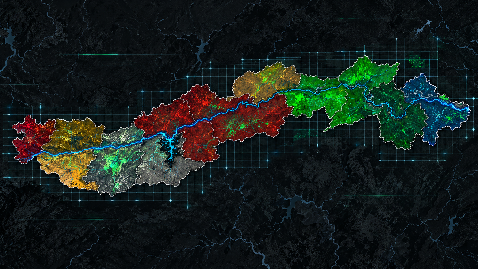
Cropin applied Sentinel imagery, weather signals and geospatial AI to monitor surface-water extent, tree density and land-use change across 12 districts in Madhya Pradesh.
What Cropin connected
The analysis combined NDWI, NDVI, precipitation, drought and tree-density signals so changing water conditions could be interpreted in context, not treated as a single satellite observation.
Decision value
The model identified positive relationships between tree-density change and water-body area in Jabalpur, Seoni, Narsinghpur and Mandla, helping direct monitoring and policy attention.
STUDY-SPECIFIC RESULT · ASSOCIATION, NOT A UNIVERSAL CAUSAL CLAIM · OUTCOMES DEPEND ON WEATHER, DROUGHT, LAND USE AND IMPLEMENTATION CONTEXT
01 / IN PRACTICE
From crop-level stress to regional drought, Cropin connects satellite, climate and farm intelligence to show where water is constraining crop performance, and which sourcing areas need attention.
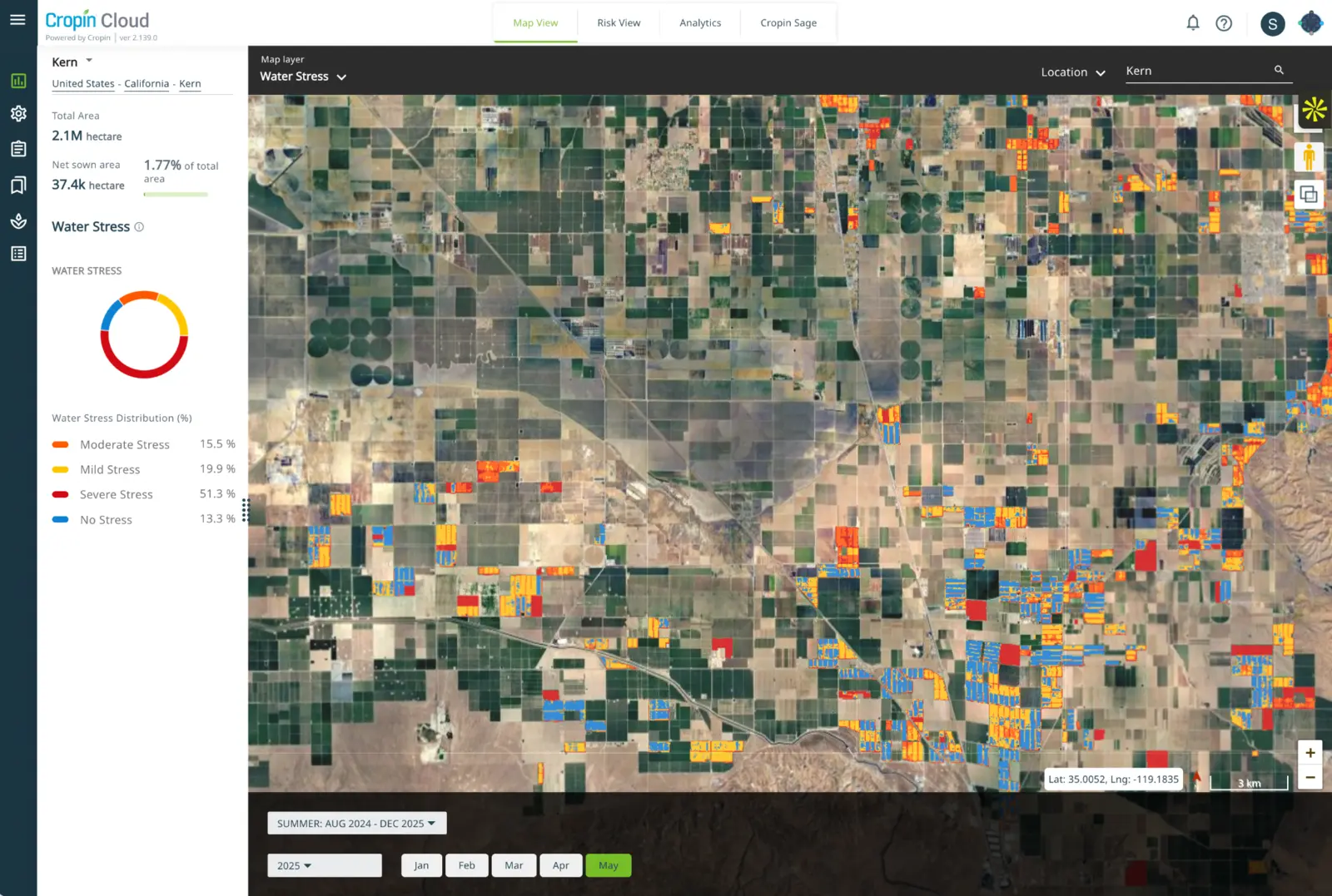
Food-Ag is one proven application. The same intelligence architecture extends to basins, utilities and water-dependent industry.Classify no, mild, moderate and severe stress across fields, quantify affected area and track how exposure changes through the season.
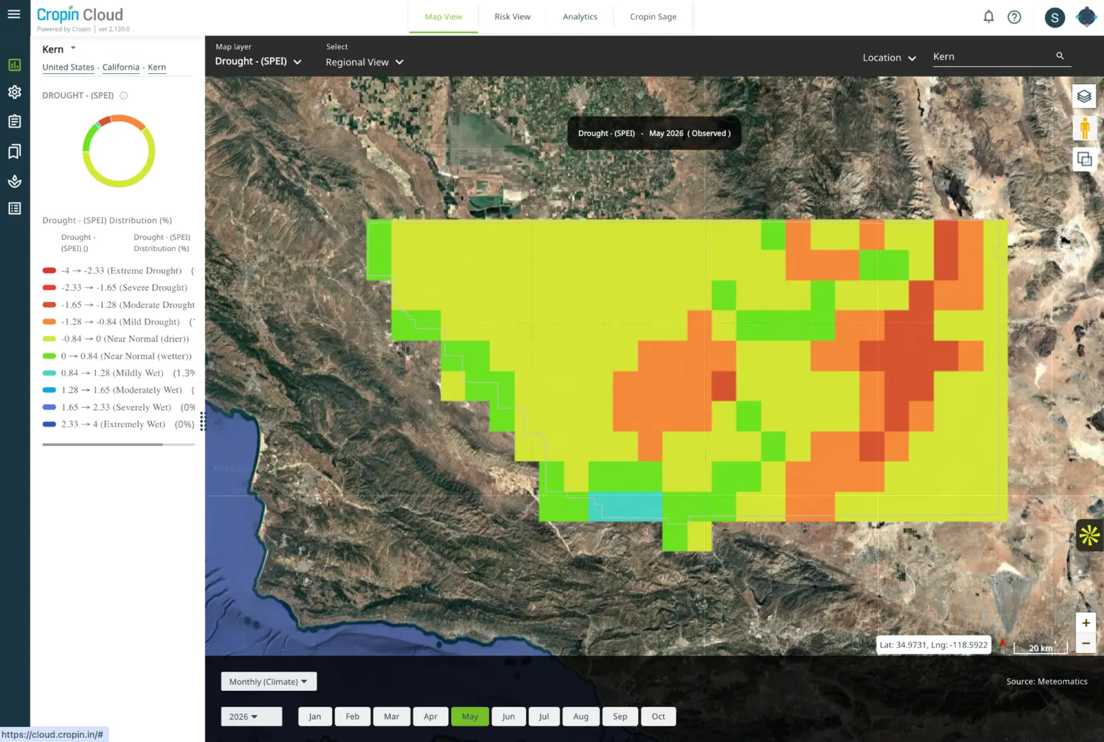
Use observed and projected SPEI conditions to understand moisture deficit across an agricultural region and anticipate where production risk is building.
Filter drought intelligence to a crop, in this example, table grapes, to identify affected production areas and prioritize agronomy, irrigation or sourcing action.
Water stress, soil moisture, rainfall and drought conditions.
Crop, field, region, season and contracted-supply context.
Agronomy, irrigation, field verification and sourcing decisions.
02 / IN PRACTICE
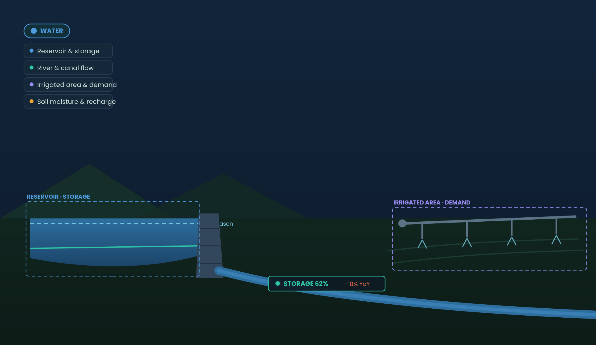
Combine reservoir storage, river and canal flow, groundwater, irrigated area, crop water demand, soil moisture and recharge to anticipate pressure before allocation decisions become urgent.
Reservoir and storage
River and canal flow
Irrigated area and demand
Soil moisture and recharge
This concept extends Cropin’s existing land, crop and climate intelligence to water systems. It does not replace utility control systems or hydrological field instrumentation.