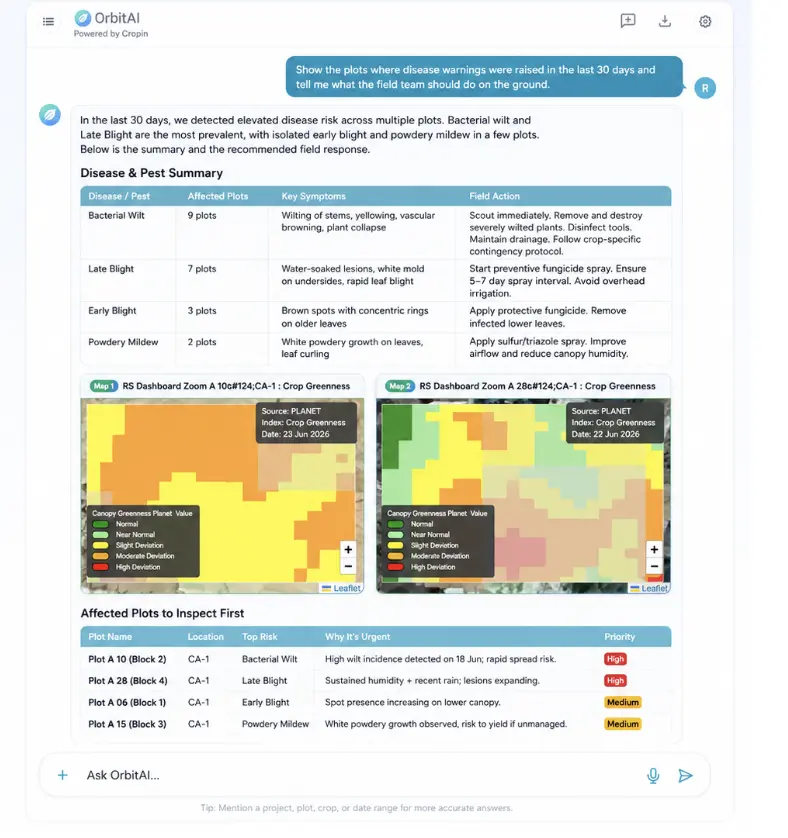
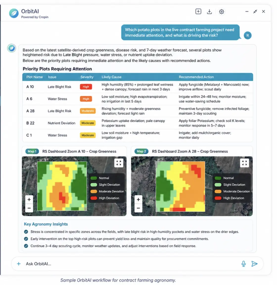
Start with the business question.
Ask by chat or voice in the language of your role, asset, region or decision.
Ask by chat or voice. OrbitAI retrieves the relevant satellite, geospatial, climate, weather, enterprise and domain evidence through Cropin’s proprietary pipelines, applies the right models and returns a contextual answer, intelligent report and governed next action.
HOW ORBITAI MAKES IT EASY
No GIS tools, satellite pipelines, climate models or specialist domain systems to operate. OrbitAI handles the complexity behind the answer.
Ask by chat or voice in the language of your role, asset, region or decision.
Cropin’s proprietary pipelines securely bring together licensed and public satellite, geospatial, climate, weather and enterprise data.
OrbitAI invokes the relevant crop, forest, land, water and risk models, knowledge and context.
Receive a contextual answer, supporting evidence, an intelligent report and governed next actions.
NO GIS EXPERTISE · NO SATELLITE PIPELINE TO BUILD · NO CLIMATE MODEL TO OPERATE · NO DOMAIN SYSTEM TO MASTER
OrbitAI live experience
No GIS expertise. No satellite pipeline to build. No climate model or domain system to master. OrbitAI securely retrieves relevant licensed and public data through Cropin’s proprietary pipelines, coordinates 22+ models and enterprise context, and returns role-aware answers, reports and practical next steps.
Explore live agents and domain coverage ↗OrbitAI in action
Available now
Food-Ag and financial-risk agents are live today. The same foundation already supports Forest & Land and Water intelligence, with additional agent workflows expanding by domain.
Explain crop progression, yield outlook and supply across plots, programs and regions.
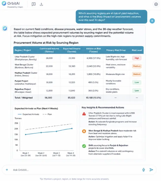
Explore Production AgentForecast supply, harvest readiness, procurement exposure and climate disruption across origins.
Explore Sourcing AgentTranslate crop and climate stress into portfolio monitoring, limits, claims and risk action.
Explore Underwriting AgentInvestigate land-use change, EUDR exposure, remediation priorities and audit-ready evidence.
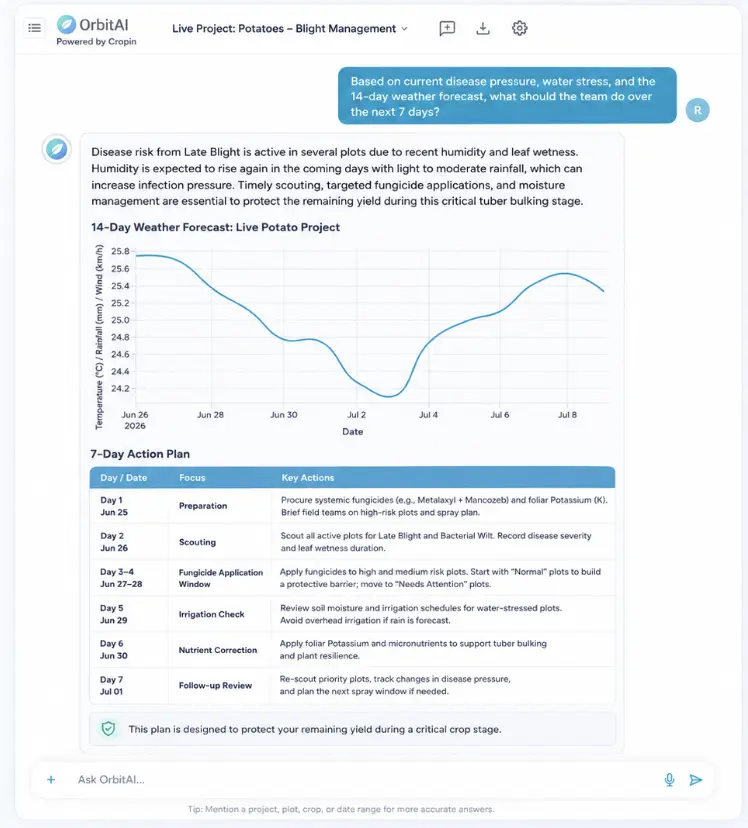
Explore Sustainability AgentDiagnose crop stage, health, disease, water and nutrient signals and recommend intervention.
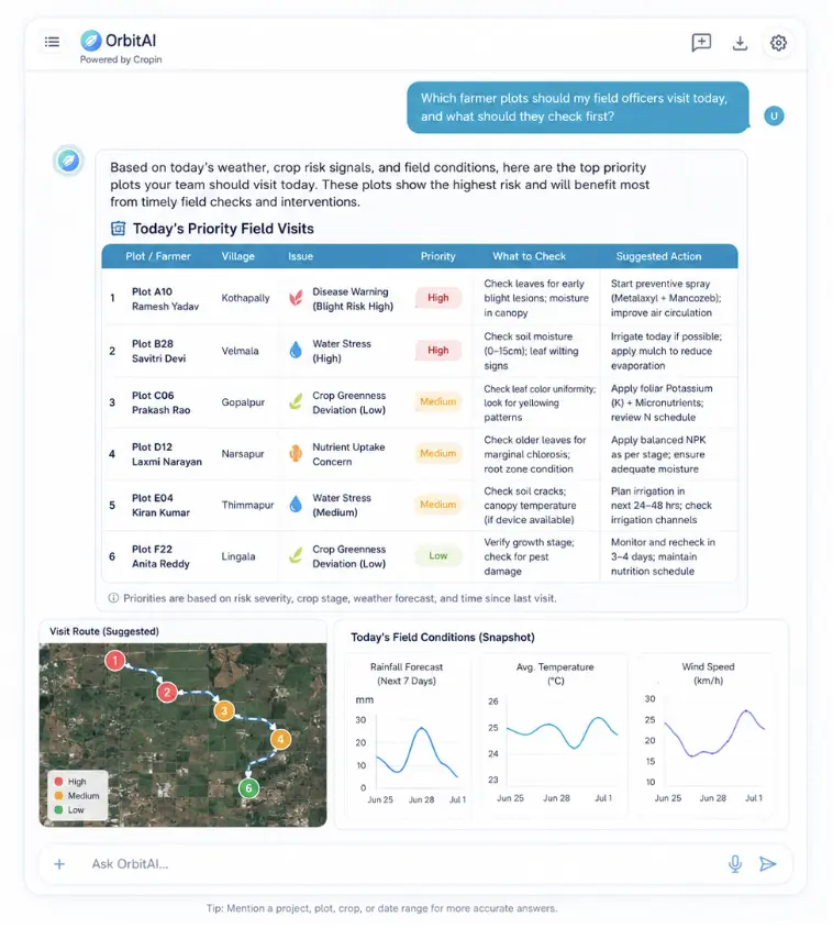
Explore Agronomy AgentTurn field, crop and weather intelligence into simple, local actions for every plot.
Built for Food-Ag business realities
OrbitAI preserves one intelligence architecture while adapting the evidence, decision logic and action to each operating model.
Compare varieties, diagnose weak plots and keep isolation, inspection and harvest activity on track.
Separate water, nutrient and disease stress, measure response and prioritize field intervention.
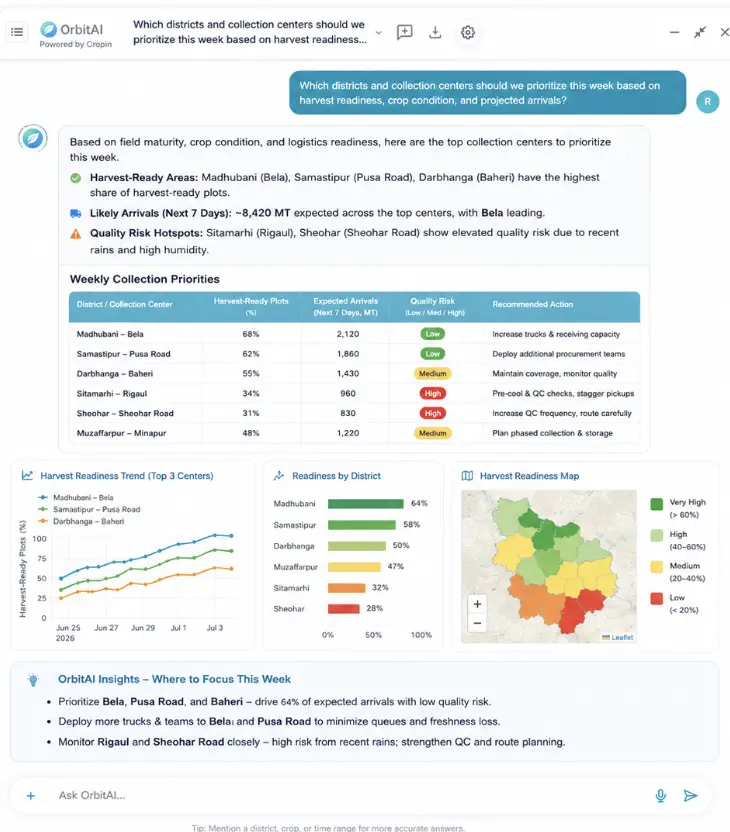
Connect crop condition, weather and harvest readiness to procurement timing and volume.
See sourcing exposure, collection readiness, partner performance and farmer action together.
The OrbitAI decision loop
OrbitAI makes the decision path visible. It gathers evidence, invokes the right models, explains exceptions and prepares the next workflow while people supervise consequential action.
↻ OUTCOMES FEED BACK INTO THE VERIFIED FOUNDATION, EVERY CYCLE SHARPENS THE NEXT DECISION
Evidence before assertion
OrbitAI shows the assets, time window, source signals, model outputs, confidence and recommended action behind the answer. It works within enterprise permissions and keeps human oversight in the loop.
Food-Ag sample use case
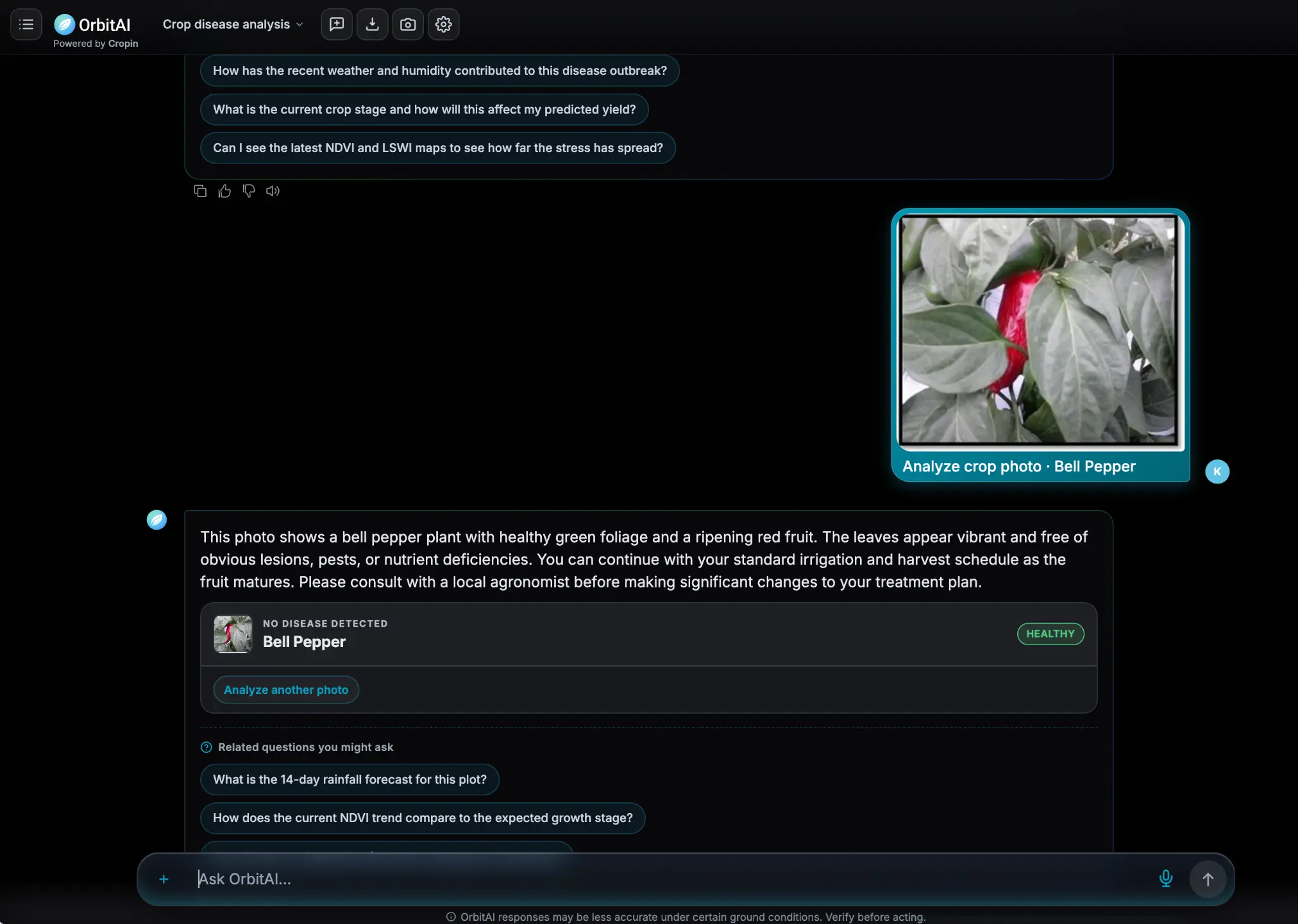
Send a crop photo through chat or voice. OrbitAI analyzes what is visibly present, explains the result, connects it with field and Earth intelligence, and suggests the next questions or approved action.
Upload a crop, leaf, fruit or field image inside the conversation.
Identify symptoms, anomalies or healthy crop characteristics.
Connect the image with weather, crop stage, NDVI, water and yield context.
Ask a follow-up, request verification or initiate an approved workflow.
In this example, OrbitAI recognizes healthy bell pepper foliage and ripening fruit, confirms that no disease is visible, and offers follow-up questions about rainfall, crop stage, yield and vegetation-index trends.
EXAMPLE FOOD-AG WORKFLOW · IMAGE QUALITY AND FIELD CONDITIONS AFFECT RESULTS · VERIFY CONSEQUENTIAL AGRONOMY ACTIONS BEFORE EXECUTION
Beyond Food-Ag
OrbitAI preserves one conversational experience while adapting the data, models and evidence to each domain’s maturity and decisions.
Carbon stock, tree crowns, tree height, plantation age, deforestation and compliance evidence.
Explore Forest & Land ↗Water stress, drought, basin conditions and Food-Ag operational exposure.
Explore Water ↗Regional expansion, borrower exposure, climate scenarios and portfolio-health assessment.
Explore financial risk ↗Vegetation, fire, climate, corridor and physical-asset exposure.
Explore the domains ↗Enterprise control
OrbitAI connects intelligence to action without removing enterprise control over permissions, evidence, review and execution.
Start with one high-value question