
Forest cover and land-use change
Earth observation + computer vision + agents
From canopy
to kernel.
Detect landscape change, preserve EUDR evidence, count biological assets and measure physical traits, then let OrbitAI route verified results into decisions and workflows.
One intelligence continuum
Observe the system at the resolution the decision requires.
Cropin combines satellite, high-resolution aerial, drone and close-range imagery with domain models. The output can move from landscape change to individual-object detection without separating the evidence from its place and time.
Tree crown, height and biomass context
Plant and fruit detection
Leaf dimensions, shade and kernel count
Deforestation and land-use evidence
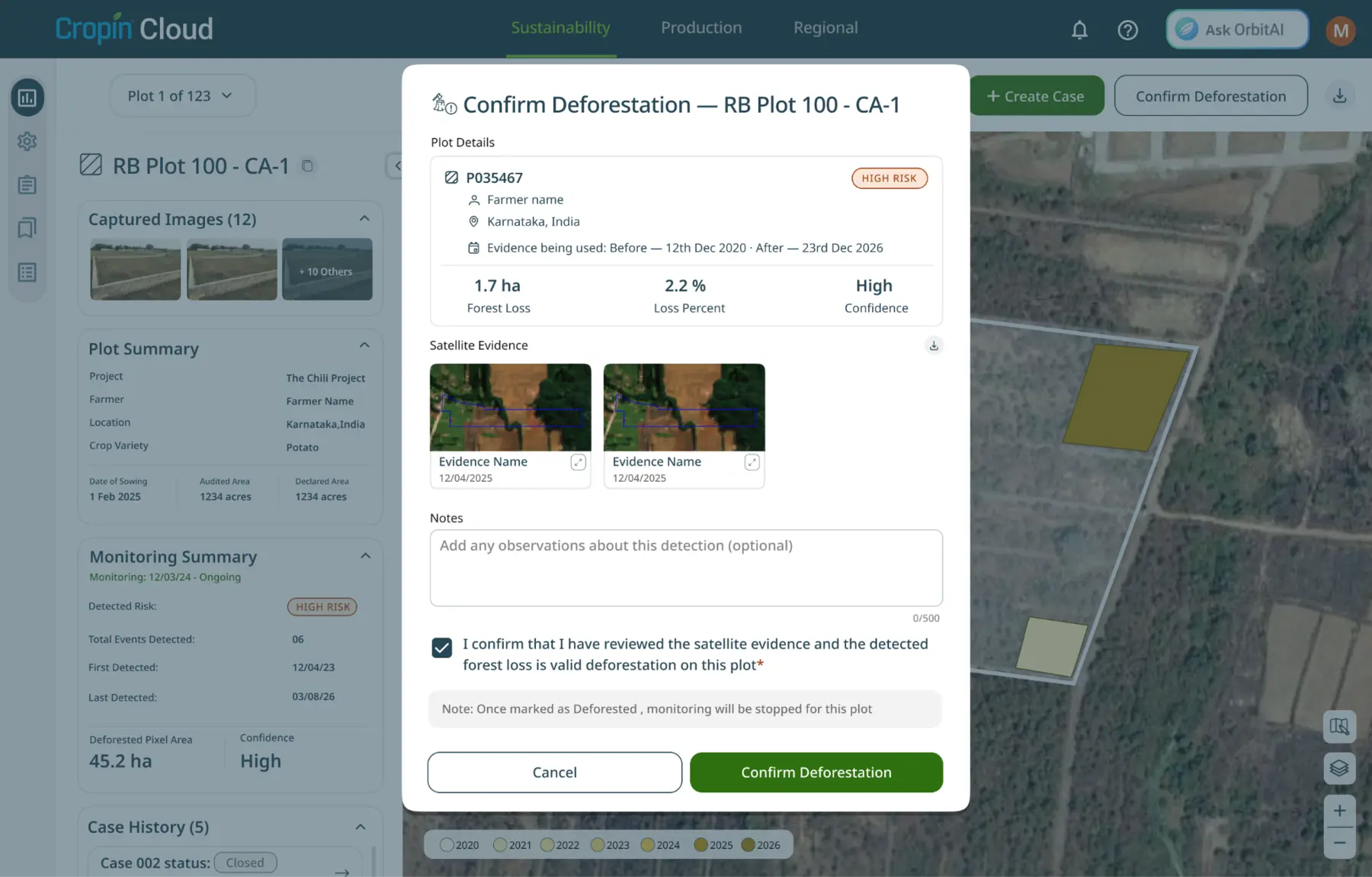
Detect change. Keep the evidence attached.
Visual intelligence should not stop at a colored change layer. Cropin connects the detected event with the plot boundary, before-and-after imagery, observation window and human review, creating a defensible record for EUDR and other land-use workflows.
Find plots that need review
Rank sourcing areas by detected land-use change and focus attention where evidence is material.
Compare the source evidence
Keep plot boundaries, observation dates and before-and-after imagery together for investigation.
Preserve human judgment
Require a reviewer to confirm or reject consequential events and retain the supporting record.
Food & agriculture vision models
Count and characterize what is physically present.
Vision models can support crop scouting, phenotyping and operational sampling by detecting plants and fruits, estimating visible canopy characteristics and counting kernels from field or close-range imagery.
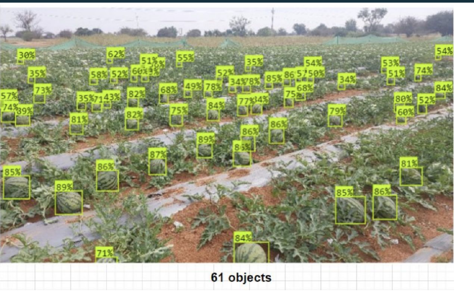
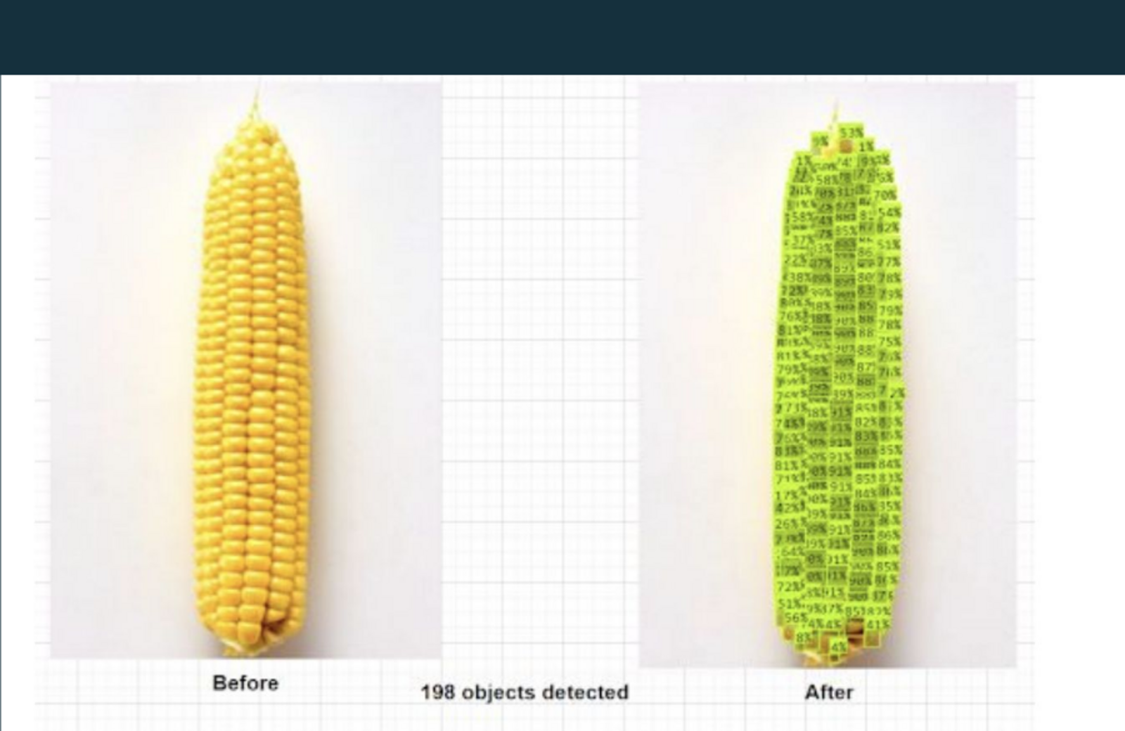
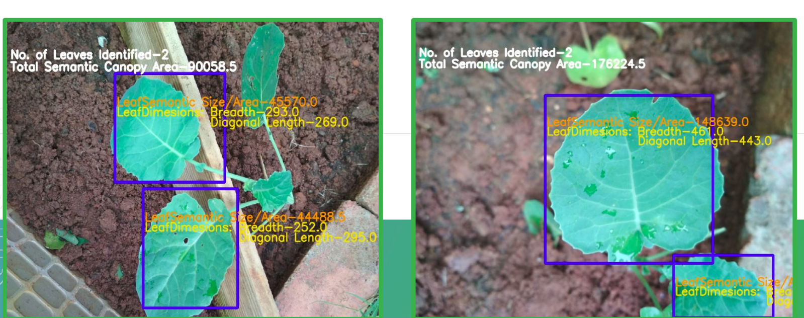
Phenotyping experiments in the supplied study used 240 in-house images spanning five shade categories under five illumination conditions. Counts shown in the imagery are example model outputs, not accuracy or performance claims.
Operationalized through OrbitAI
The agent does not replace the model. It makes the model useful.
OrbitAI can select the relevant imagery and model, compare the result with historical and enterprise context, identify exceptions, request human verification and prepare the next action.
01Ask
“Where did canopy decline?”
02Invoke
Run the appropriate vision and domain models.
03Verify
Check confidence, history and field evidence.
04Recommend
Prioritize inspection or intervention.
05Act
Update the approved enterprise workflow.
CAPABILITY EVIDENCE FROM CROPIN STUDIES · DEPLOYMENT DESIGN, SENSOR AVAILABILITY, CALIBRATION AND VALIDATION DEPEND ON THE ASSET, GEOGRAPHY AND DECISION · PROPRIETARY MODEL IMPLEMENTATION IS NOT DISCLOSED
Bring us the asset and decision