
Production visibility
Monitor acreage, crop stage and crop condition.
Crop intelligence
Enhance rice farm productivity with plot-level insights, pest management, irrigation advisories, and yield forecasting. Designed for agri-business efficiency and planning.
Crop-specific intelligence
Connect plot observations, Earth observation, weather and crop-specific models to production, sourcing and risk workflows.
Monitor acreage, crop stage and crop condition.
Prioritize fields using water, weather and crop-health signals.
Estimate timing and likely production windows.
Connect expected harvests to procurement and processing needs.
01 / CROP INTELLIGENCE
Rice is the staple for over 3.5 billion people worldwide, especially in Asia, with a 90% consumption rate.
Seed · nursery · soil
Stand · water · timing
Canopy · nutrition · vigor
Growth · lodging risk
Water · nitrogen · heat
Sterility · weather exposure
Moisture · quality · yield
Window · loss · supply
Cropin combines crop-specific knowledge with verified field observations, Earth observation, weather and enterprise data.
02 / CROP INTELLIGENCE
Water Scarcity and Climate Change; Pests, Diseases, and Weeds; Soil Degradation and Yield Gaps are the top challenges in rice production.
03 / CROP INTELLIGENCE
The same operating loop supports growers, agronomists, sourcing teams, processors and enterprise leaders.
Field activity, satellite, weather, climate and enterprise data.
The rice crop: variety, stage, geography and agronomic context.
Crop progression, stress, disease, yield and harvest readiness.
Prioritized advisories, field workflows, sourcing and supply decisions.
Ask what changed, investigate the evidence and decide what happens next.
Experience OrbitAI ↗04 / CROP INTELLIGENCE
Crop-specific intelligence is validated through operating programs, not isolated demonstrations.
Acres digitized on Cropin platform
05 / CROP INTELLIGENCE
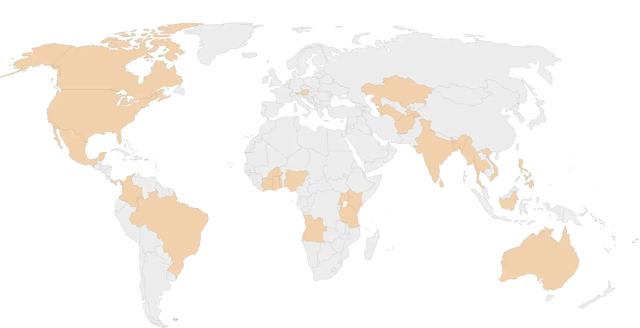
While only a small percentage of global rice production is traded internationally (around 8%), disruptions in production in major exporting or importing countries can significantly impact global food prices and economic stability.
06 / CROP INTELLIGENCE
Explore how the same verified foundation adapts to different crop biology, risks and enterprise decisions.
These are selected examples from Cropin’s broader crop intelligence library.
07 / CROP INTELLIGENCE
Go deeper into the operating practices, technology and customer outcomes behind the crop intelligence.
Unlock smarter crop cultivation with Cropin. Make your food production, sourcing, and supply predictable, profitable, and sustainable.
Our in-depth market report delves into the intricacies of Nigeria's paddy cultivation. By harnessing the power of satellite data...
Read more CASE STUDYA deep dive into a leading seed producer's transition to near real-time monitoring and management of seed production operations...
Read more CASE STUDYHow CropLens uses remote sensing and geographic information system technology to drive pest control in smart rice farming....
Read more08 / CROP INTELLIGENCE
Cropin AI models use proprietary crop knowledge grid, satellite data, and weather forecasts to guide farmers on optimal water usage. The platform recommends when and how much to irrigate, helping reduce water wastage while ensuring healthy crop growth, even in water-scarce regions.
Growth index analysis per plot involves tracking crop health and growth at the individual field level using satellite imagery and AI. By monitoring each plot, Cropin identifies underperforming areas, predicts yields, and suggests timely interventions, allowing farmers to make precise, data-driven decisions.
Cropin combines Geographic Information System (GIS) mapping with remote sensing data to detect stress patterns in rice fields that may indicate pest infestation. This allows farmers to identify hotspots early, target pest control measures efficiently, and prevent large-scale outbreaks. Cropin Disease Early Warning System (DEWS) provides alerts on probablity of disease occurrence to implement mitigative steps.
Cropin’s DEWS monitors key rice diseases and pests, including: Bacterial blight, Sheath blight, Rice blast, Brown spot, Brown planthopper. The system provides early alerts and management recommendations, reducing crop loss and chemical overuse.
Cropin analyzes soil health, nutrient levels, and historical crop data to recommend targeted interventions like crop rotation, organic amendments, and optimized fertilization. This approach restores soil fertility, improves long-term yields, and ensures sustainable rice cultivation.
Using the Space4Good collaboration as a benchmark, Cropin utilizes radar and optical satellite imagery to identify rice plots even through cloud cover. This is critical for rice, as it is often grown during monsoon seasons when traditional satellite visibility is low.
Rice cultivation is a major source of methane emissions. Cropin enables the monitoring of “Alternate Wetting and Drying” (AWD) techniques. By digitizing water management logs and verifying field conditions via satellite, the platform provides the “Evidence” needed for carbon credit certification and sustainable rice labels.
Cropin uses satellite intelligence to detect the exact date of transplanting across thousands of hectares. This allows companies to precisely calculate the crop’s lifecycle and predict harvest dates with high accuracy, optimizing the procurement window for millers.
Yes. By integrating historical weather patterns with real-time flood monitoring, the platform can estimate potential yield losses during a flood event and adjust final output forecasts. This helps rice exporters and government agencies to proactively manage food security risks.
Direct Seeded Rice (DSR) is a more water-efficient method than traditional puddling. Cropin provides field officers with digital workflows to guide farmers through the specific “Package of Practices” (PoP) required for DSR, ensuring correct seed depth and weed management to maximize the variety’s potential.
Cropin combines satellite-derived evapotranspiration data with pincode-level weather data to calculate the water productivity of rice crops. This allows organizations to identify which clusters are using water most efficiently and where irrigation interventions are needed.
The platform’s “Disease Early Warning System” alerts agents when growth stage, temperature, and humidity levels reach the threshold for BPH or Rice Blast. Agents can then send localized “In-App” advisories to farmers to take preventive action before the pest destroys the crop.